Trout Creek Restoration
Project Details
LEAD AGENCY
City of South Lake Tahoe
FUNDING PARTNERS
California Tahoe Conservancy / United States Bureau of Reclamation / Tahoe Regional Planning Agency / Lahontan Regional Water Quality Control Board
LOCATION
Help Protect Tahoe

Help protect Lake Tahoe’s clear blue waters, mountain forests, and world-class recreation by ordering your Tahoe Plate today.
Get Your Tahoe Plate
Overview
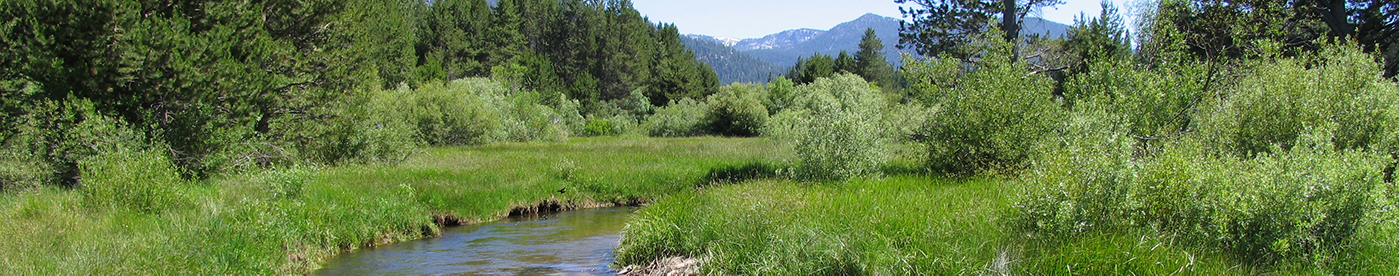
At 40 square miles, Trout Creek is the second largest watershed in the Tahoe Basin. The creek meanders from the highest elevations of the Basin, through the urban areas of the City of South Lake Tahoe, until it enters Lake Tahoe at the Upper Truckee Marsh. The Trout Creek Wildlife Enhancement and Stream Restoration Project restored the natural processes and functions along approximately 3.5 miles of the lower reaches.
Restoration Opportunities
In 1982, the City of South Lake Tahoe acquired a significant portion of the Trout Creek floodplain. The area had undergone significant disturbances over the past 150 years, including grazing, logging, and stream channelization – disturbances which degraded aquatic and terrestrial habitats and increased nutrient and sediment loads entering Lake Tahoe. In the mid 1990s, a planning effort was initiated to restore the stream channel and the adjacent meadow. The Conservancy provided a site improvement grant for $425,000 to the City that contributed to the overall construction costs.
Approach
The primary goal of the project was to restore the stream to its historic conditions. The new channel was designed to be smaller and more sinuous, increase flood frequency and duration, raise groundwater levels, improve vegetation, and enhance wildlife habitat.
Status
Between 1999 and 2001, the City constructed approximately 3.5 miles of new stream channel and restored 107 acres of meadow. Since completion in 2001, project monitoring has verified vast improvements. The restored Trout Creek has improved water quality and enhanced surrounding meadows by reducing channel erosion and retaining sediment on the floodplain